


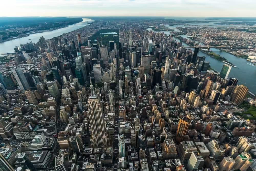
Manhattan is easier to understand when you stop treating neighborhoods as fixed boxes. Neighborhood names often overlap, while official boundaries, community districts, and local usage can differ.
For visitors and new residents, a Map of NYC Neighborhoods should answer practical questions:
- Where am I?
- What neighborhood am I entering?
- How far is the next area?
- Which subway line serves the location?
Those answers affect accommodation, sightseeing, commuting, dining, and daily errands.
After 15 years around Manhattan, I recommend using neighborhood names as a starting point, then checking the exact street address.
If you do so, that can prevent numerous common planning mistakes.
How to read a Manhattan neighborhood map
Explore NYC Neighborhoods Map Click a marker for the neighborhood name, or use the layer switcher (top right) to show/hide boroughs.
The easiest way to understand Manhattan is from south to north. Lower Manhattan includes the Financial District, Battery Park City, Tribeca, Civic Center, Chinatown, SoHo, NoHo, Little Italy, and the Lower East Side. Farther north, you reach Greenwich Village, West Village, Chelsea, Flatiron, Union Square, NoMad, and Midtown.
Midtown includes Times Square, Hell’s Kitchen, Garment District, Hudson Yards, Murray Hill, and Turtle Bay.
Above Central Park, the Upper East Side, Upper West Side, Harlem, Washington Heights, and Inwood cover much of northern Manhattan.
The Map of NYC Neighborhoods becomes more useful when you combine neighborhood names with major streets and avenues. Fifth Avenue, Broadway, Central Park, Houston Street, 14th Street, 34th Street, 42nd Street, 59th Street, 86th Street, 110th Street, and 125th Street give you practical reference points.
Usually, the street address matters more than the neighborhood name.
NYC Department of City Planning distinguishes between formal geographic systems and locally used neighborhood names. Community districts provide official administrative boundaries, while neighborhood names can have less precise borders.
Manhattan neighborhood boundaries are not always fixed.
This, in fact, is where many visitors get confused.
A neighborhood can have a strong local identity without having one universally accepted border. Real estate listings, hotels, restaurants, residents, community boards, and city agencies can use slightly different geographic descriptions.
For example, SoHo borders NoHo, Chinatown, Little Italy, Tribeca, and Greenwich Village. The exact point where one area ends and another begins matters less to a tourist than knowing where the location sits relative to major streets and subway stations.
The same applies to the Upper East Side and Upper West Side. Central Park provides a clear dividing line, but smaller neighborhood distinctions become more local as you move north.
Do not use a neighborhood name as an exact location. Use the neighborhood plus the cross street.
“Upper East Side” gives you the general area. “Upper East Side near 86th Street and Lexington Avenue” gives you a useful location.
NYC has 12 community boards in Manhattan, each covering a defined geographic area. These provide another official reference when you need to understand local boundaries.
You may also like: Manhattan Neighborhoods Map: 11 Neighborhoods Explained
The Manhattan neighborhoods you should know
1. Lower Manhattan
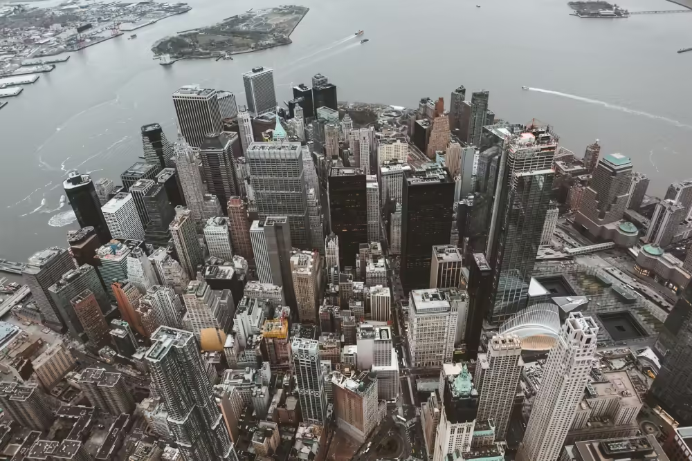
The Financial District occupies the southern tip of Manhattan and includes Wall Street and the surrounding business district. Battery Park City sits along the Hudson River, while Tribeca extends north of the Financial District.
SoHo, Chinatown, Little Italy, NoHo, and the Lower East Side sit nearby.
Street patterns become less predictable here. Do not assume the regular Manhattan grid works the same way downtown.
2. Greenwich Village and West Village
Greenwich Village is another area where the street grid becomes irregular. Washington Square Park provides a useful reference point.
The West Village has narrow streets and frequent turns. If you are walking in this part of Manhattan, check the actual route rather than estimating distance from the map.
Sometimes a destination that looks close requires more walking than expected.
3. Chelsea and Flatiron
Chelsea sits on the west side of Manhattan, while Flatiron sits farther east around Madison Square Park. Union Square connects several nearby areas.
These neighborhoods provide access to restaurants, galleries, shopping, offices, parks, and multiple subway routes.
The exact avenue still matters. A location closer to the Hudson River provides a different commute from one near Sixth Avenue.
4. Midtown
Midtown contains many major visitor destinations, including Times Square, Rockefeller Center, Bryant Park, Grand Central Terminal, Penn Station, and the Theater District.
Do not assume every Midtown address provides the same access.
A hotel several avenues west of Fifth Avenue can have a very different walking and subway experience from one near Grand Central.
5. Upper East Side and Upper West Side
Central Park separates the Upper East Side from the Upper West Side.
The Upper East Side sits between Central Park and the East River. The Upper West Side sits between Central Park and the Hudson River.
Both areas extend for many blocks, so the exact cross street matters. A restaurant described as being on the Upper West Side might sit near Lincoln Square, 72nd Street, 86th Street, or much farther north.
You may also like: Manhattan Zip Code Map, From 10001 To 10282
6. Harlem, Washington Heights, and Inwood
Harlem covers a large area and includes smaller areas such as Central Harlem and West Harlem.
Washington Heights and Inwood sit farther north. These neighborhoods have subway access, but they are much farther from Lower Manhattan.
For tourists, check travel time before adding northern Manhattan destinations to a downtown itinerary. For residents, commute time matters even more.
How to plan routes across Manhattan?
The biggest practical mistake is planning a day by attraction rather than geography.
Suppose you want to visit SoHo, Central Park, the Empire State Building, and the Upper West Side. Visiting these places in random order creates unnecessary travel.
Instead, group destinations by area.
Start downtown and move north, or start uptown and work south. Avoid crossing Manhattan repeatedly when you can.
Always check the subway route before leaving. A location that looks close on a map may have a better subway connection from another station.
On the flip side, a destination slightly farther from your hotel may be easier to reach if a subway station provides a direct route.
For new residents, use the same approach when choosing an apartment. Check the nearest subway station, grocery store, pharmacy, major avenue, and your normal commute.
That information often matters more than the neighborhood label.
How locals use neighborhood maps
Visitors often think in terms of attractions. Locals tend to think in terms of routes.
If someone says, “Meet me in SoHo,” that is not enough for a precise meeting point. A local will usually add a street, avenue, subway station, or landmark.
The same principle applies when choosing an apartment.
Look at the exact address. Then check the nearest subway station, your regular commute, grocery options, restaurants, parks, and the streets you will use most often.
Last thing to remember
The map of NYC Neighborhoods works best when neighborhood names are combined with:
- Streets
- Avenues
- Subway stations
- And exact addresses
So better plan Manhattan by geographic zones, instead of moving randomly between attractions. This reduces unnecessary travel and gives you more usable time.
Last but not least, for hotels, apartments, restaurants, and offices, always verify the exact location. The neighborhood provides context, but street-level geography determines your experience.
